Leveraging ground sensor technology and an Internet of things (IoT)-type platform, industries have moved from reactive maintenance in which repairs and maintenance are scheduled following recurring physical visits at sites, to preventative maintenance—providing more frequent and repeatable data sets from the assets that can be collected in real time, and compared to detect trends. Once analyzed these trends allow asset managers to implement preventative actions, reducing the long-term cost of maintenance, extending the availability and the life of the assets, and increasing the overall field production.
However, the major downsides of implementing ground sensors on numerous assets over broad areas are limited return on investment if the asset production life cycle is less than 10 years, and obsolescence of the technology if the asset life cycle is more than 10 years.
Based on our current unmanned aerial system (UAS) flying operations with oil and gas majors, we now see the inspection industry complementing its ground sensors with the introduction of aerial remote sensing and information delivery technologies at scale as a way to mitigate these costs and obsolescence issues.
There are many reasons why beyond line of sight (BVLoS) UAS flying operations have not yet fully been integrated into civilian operations and, as a result, most industries limit the role of unmanned aircraft vehicles (UAVs) to close inspection of vertical infrastructure or capability demonstration. This is primarily due to the perceived restrictive nature of airspace regulations when it comes to the integration of UAS into the civilian airspace.
Airspace regulatory bodies such as the US Federal Aviation Administration (FAA) and Australia’s Civil Aviation Safety Authority (CASA) have begun opening a portion of the sky to line of sight UAS operations (e.g., Part 107 in the US). A lesser known fact is that the same airspace regulatory bodies may consider BVLoS flying operations based on a safety case (e.g., Section 2210 of the FAA Extension, Safety, and Security Act of 2016 for operations associated with critical infrastructure in the US). This means that with proper coordination and management of a client’s timeline, it is possible to conduct BVLoS UAS flying operations today—provided that the UAS operator mitigates the risk of introducing a UAS into the civilian airspace with operational and technological remediation.
The benefit that line of sight (LoS) remote sensing operations bring to industrial operations is now well known and shared in the industry in particular, for vertical infrastructure inspection. However, what is underestimated is the same benefit applied at scale, over an entire basin thanks to BVLoS UAS operations.
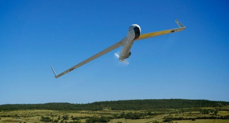
A case in point is the flying operations conducted by the Insitu Asia-Pacific team in Australia to remotely inspect Shell QGC’s LNG assets with the support of Boeing Phantom Works International, where the ScanEagle UAV flies every week of the year over the Coal Seam Gas field of the Surat basin into an unsegregated civilian airspace.
Our experience flying ScanEagle UAS BVLoS over broad areas (1,000+ km2) shows that the productivity of ground teams in charge of the assets can be significantly improved (up to 20%). Indeed, the number of assets being inspected per day can by multiplied by a factor of 10 using BVLoS UAS operations. This allows any given team to review all their assets in one day, and focus the rest of the week doing “things” (planning, fixing, repairing, maintaining, etc.), reducing the number of hours spent on unproductive tasks (driving, inspecting visually mundane checkpoints, drafting manual reports, etc.).
Another significant benefit of utilizing an UAS BVLoS as part of an asset management operation is how it enhances the safety of the ground teams. With the introduction of broad area remote inspection, the average distance driven every year diminishes drastically (down 500,000 km per team, per year on average). This, in turn, statistically reduces road hazard accidents. Another more anecdotal but equally important safety aspect is the ability to detect threats to ground teams before exposing them to risks (e.g., wildlife or leaks).
The above augment the primary gain of utilizing a UAS BVLoS to inspect assets over broad areas, which is the improvement overall in asset availability. Being able to constantly monitor the assets and detect issues before they arise enable the ground teams to deploy preventative maintenance, changing the way they conduct their operations in order to achieve a very high level of sustained production, and reduce the asset down time (up to 66% reduction) when needed. The true economic value here is at such a scale that it is difficult to define (or share) but the potential is certainly huge.
In summary, the benefits of remote sensing using UAS BVLoS at scale are “no brainers” for asset managers, and the winning asset managers will be the ones making the most of the existing technology and regulations, and leveraging them to get an edge over the competition with the most cost-effective operations. UAS BVLoS operation is one of these rare remote sensing technologies of the future that can be deployed in your everyday operations!